Dubai Municipality has launched Dubai Atlas, a comprehensive geographical and knowledge reference that documents the emirate’s transformation over the years, from changes in its urban landscape and natural environment to the development of its infrastructure and community facilities.
Bringing together geographical data, maps, aerial photographs, and satellite imagery, the publication offers a detailed view of Dubai’s physical landscape, its development journey, and the opportunities shaping its future. It also provides an accessible way to understand the different elements of the city and how they have evolved while reflecting Dubai’s distinctive identity.
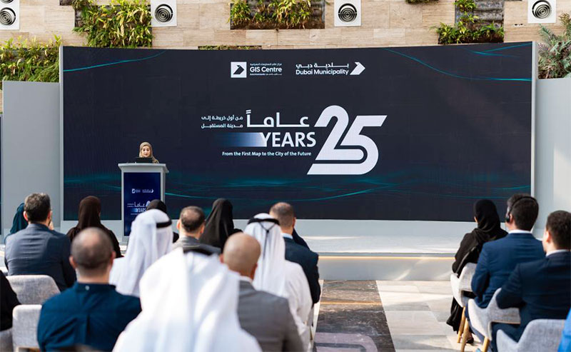
The atlas was unveiled during an event organized by Dubai Municipality to celebrate 25 years of the Geographic Information Systems (GIS) Center, marking an important milestone in the center’s work to develop geospatial knowledge and support the emirate’s continued growth.
Historical Maps and Satellite Images Reveal Dubai’s Growth in Infrastructure, Transportation, and Community Services
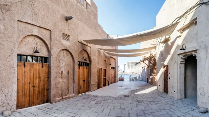
Through a collection of maps, aerial photographs, and satellite images, Dubai Atlas traces the geographical and urban changes that have taken place across the emirate. Its coverage extends from population distribution and transportation networks to infrastructure, cultural and heritage landmarks, and the community services that form part of everyday life in Dubai.
Historical maps are another important feature of the publication, preserving a visual and geographical record of the emirate’s development across different periods. Together, these materials allow readers to follow how Dubai’s urban landscape has changed and gain a clearer understanding of the city’s growth.
The atlas is organized into 10 chapters covering geospatial information, population, roads and transportation, the environment, culture and heritage, religious landmarks, education, healthcare, community facilities, and historical maps. By bringing these subjects together, the publication provides a connected picture of Dubai’s geographical features, infrastructure, and development.
Dubai Atlas Highlights the Emirate’s Natural Environment and the Growing Role of Smart City Technologies
Beyond the built environment, Dubai Atlas explores the emirate’s natural diversity, with dedicated coverage of nature reserves, ghaf trees, green spaces, farms, food security, dams, and mountain trails. These sections offer insight into Dubai’s environmental characteristics and their connection to urban planning and sustainable development.
The publication also examines how geographical information supports essential government and municipal functions. Its applications range from urban planning, land management, building permits, and transportation planning to traffic analysis, emergency response, crisis management, and the monitoring of natural resources.
It further highlights the importance of geospatial applications in advancing smart city initiatives, digital twins, artificial intelligence, and big data analytics. These technologies support more efficient city management, better resource planning, and preparations for future needs and challenges.
Dubai Municipality Emphasizes the Importance of Geospatial Data in Urban Planning and Preparing for the Future
Maryam Al Muhairi, Executive Director of the Buildings Regulation and Permits Establishment at Dubai Municipality, said: “Dubai Atlas represents one of the distinguished knowledge publications presented by Dubai Municipality, and a rich and comprehensive knowledge, geographical, and visual reference for the Emirate of Dubai. It is also a valuable addition to the geospatial knowledge system, connecting geospatial data and maps within a context that helps understand the city and examine its transformations. It also reflects our commitment to developing the geospatial data system, improving the quality of information, making it available, and utilizing it in urban planning and anticipating the future, thereby supporting more accurate and proactive decision-making.”
She added: “Our goal is for geospatial data to become a fundamental pillar in planning the city, managing its operations, and anticipating its future needs, and to utilize the capabilities of digital twins and advanced technologies to build a comprehensive and interconnected understanding of Dubai’s components. This will enhance the efficiency of planning and resource management, increase the city’s readiness to deal with future changes and challenges, and reinforce Dubai’s position as a global model for smart and future-ready cities.”
Strategic Partnerships and Advanced Geospatial Applications Strengthen Dubai’s Position as a Global Leader in Smart City Development
Dubai Municipality continues to emphasize cooperation and knowledge exchange with partners across the public and private sectors, particularly in developing geospatial applications and expanding the use of advanced technologies in city management.
These partnerships support the exchange of specialized expertise, the development of joint solutions, and new opportunities for innovation in areas such as digital twins and other emerging technologies. They also contribute to efforts to improve quality of life and develop applications that respond to the city’s needs.
Maitha Al Nuaimi, Director of the Geographic Information Systems Center Department at Dubai Municipality, said: “World Geographic Information Systems Day is an occasion to strengthen cooperation with our partners and expand it into broader areas of knowledge and expertise exchange and the development of joint solutions. This supports the integration of efforts between the public and private sectors and draws on specialized experiences to accelerate innovation and develop geospatial applications that respond to the city’s needs and support quality of life. Through these partnerships, we are working to expand the scope of cooperation in the fields of digital twins and advanced technologies, reinforcing Dubai’s position as a globally leading city in utilizing modern technologies for city management.”